Martha Property History
Martha Trail by Jocelyn Knight
The history of the Martha Property, and its long, circuitous, often arduous journey to this moment in time, is, to say the least, quite complex.
It has involved scores of people, families, generations, legal machinations, and government agencies and rulings. It has seen proclamations, judgments, lawsuits, consultants’ reports. It has known proposals to develop, proposals against development. It has used both contentious rhetoric, and conciliatory language.
Oh, it has been a busy history. One cannot say that this remarkable land, perched high atop a peninsula overlooking such stirring beauty, has been one short on attention or controversy.
But through all the aches and pains stretching out over the years like Martha rising and falling over her 110 acres, one thing is certain, a different history is being written:
It will be a visual, alive, and natural history;
It will be a history with a forever open future;
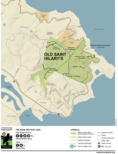
It will write new history, too, as it rests adjacent to and joined with Old St. Hilary’s Open Space Preserve;
It will live as a shining example of how local citizens, for decades, working hard together and with common purpose, can make good and forever things happen. Such is this grand marriage of St Hilary, and now Martha. It will live on as proof of what caring citizens can do; And, as history often does, it will look back at contention and smile. It will cast its gaze instead upon open space, an island, a Bay, a Bridge, and a forever future.
History will smile. She will see land preserved and free for living things to roam, sit upon, nest in, and enjoy…forever.
Now, that’s quite a history.
P.S. Should you like to learn about the actual history of Martha, here is a timeline:


